
Baker
Climbing Wheeler Peak
A popular activity for those who visit Baker is to climb Wheeler Peak, the second highest peak in the state of Nevada, at 13,063 feet. Most who climb it do so in summer and fall, when it’s possible to drive to the 10,000-foot high trailhead. From there, it’s an 8.2-mile round trip that typically takes five to seven hours. (Or for a bunch of moms and seven and eight-year olds last summer on a very windy day, it took nine hours. You can read the account here.)
Those who climb the peak in early summer enjoy big patches of snow. By early July, flowers abound, including the tall and colorful Parry’s primrose, which is a surprise up here because it usually grows near riparian areas. In the fall, a trip to the top allows for a chance to see the yellows, oranges and reds of fall foliage.
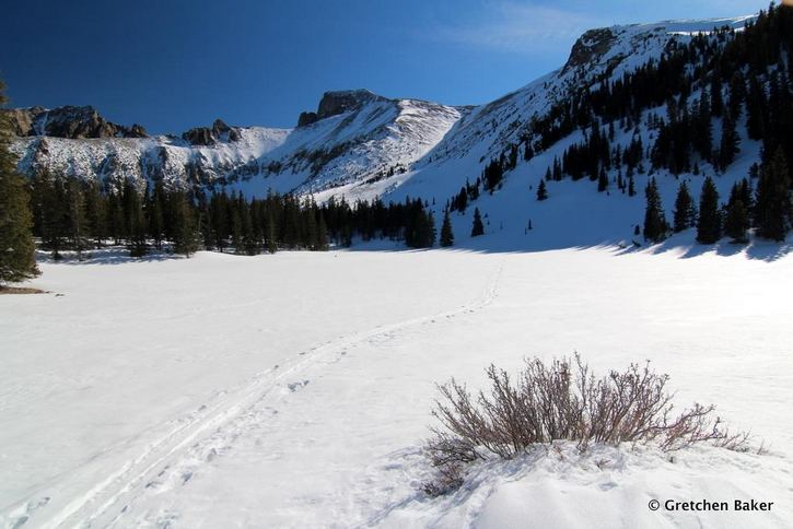
Not many people climb the peak in winter and spring, but it is possible. The Wheeler Peak Scenic Drive is closed, so the starting point changes to the Upper Lehman Creek Campground. From there, it’s a short walk/ski/snowshoe to the trailhead, and then 3.4 miles up to the Wheeler Peak Campground, with a 2,400 foot change in elevation.
I made the winter ascent recently, after many summer and fall ascents. It was a strenuous, two-day venture, but the scenery was outstanding. On the first day, five of us hiked up to the Wheeler Peak Campground and made our camp. With our snowshoes, we stomped down flat spots for our tents, clearing them further with shovels. We lucked out with water, finding a patch of visible creek. We dug out the picnic table so we would have something to sit on.
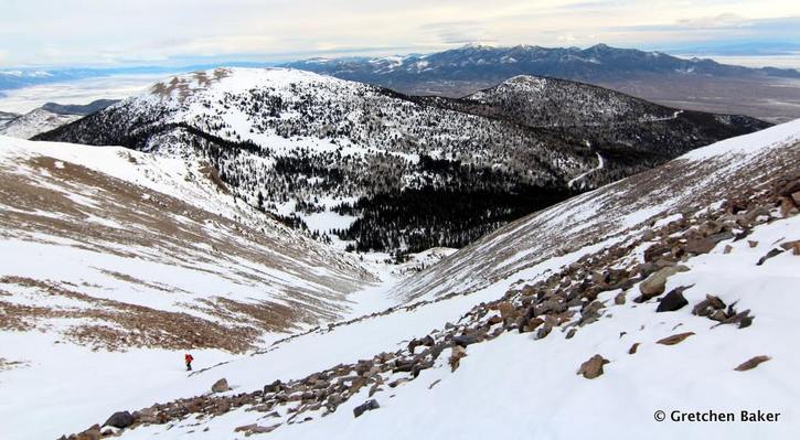
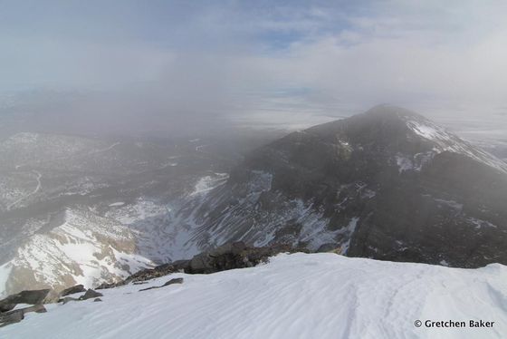
On the second day, we started snowshoeing about 4:30 a.m. With our headlamps, we followed the tracks we had made the previous day to Stella Lake. Instead of following the summer trail, which was under two to three feet of snow, we went up a gully by Stella Lake, which was more of a straight-line ascent. The snow was hard packed, so even though it was steep, our snowshoes worked well. At the top of the gully, the peak didn’t look that far away. The wind had blown snow off many of the rocks, enough so that three of us took off our snowshoes to continue in our mountaineering boots, and one switched to crampons.
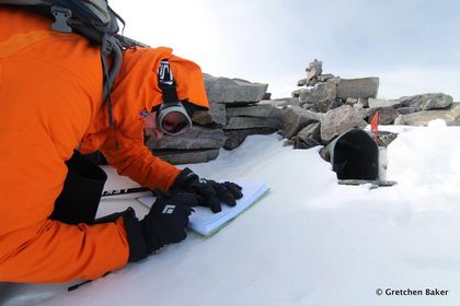
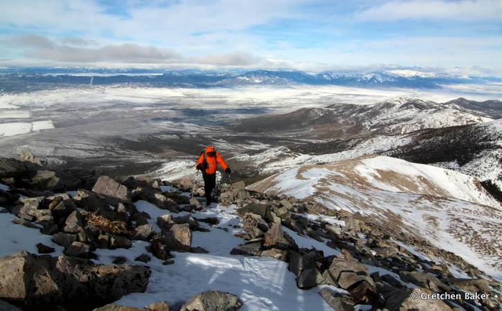
The cold wind blew hard, but it wasn’t enough to stop us from reaching the top. The views were amazing — for a couple minutes. Then the clouds came in, making for some dramatic scenery. We hurriedly posed for a group photo and signed into the register, located in a mailbox in one of the old heliograph stations, marked by a chest-high small room of piled rocks.
The heliograph station was used to help map the West along the 39th parallel. In 1881, H. J. Davis of the U.S. Coast and Geodetic Survey stayed in a round rock building topped with a canvas roof from August to December, as part of a reconnaissance mission. He decided the peak would work well, and the following year William Eimbeck came with a huge crew to lug the 200-pound transit, along with 10,000 pounds of other gear, up the mountain. While he and his crew were on the summit flashing signals to men on other mountaintops, a storm arrived, leaving them with 10 to 12 foot deep drifts and temperatures dipping to minus 20 degrees Fahrenheit. Despite the harsh conditions, they eventually accomplished their mission, making much more accurate maps of the area.
Before we started down the mountain, two of us put on crampons, which greatly aided in stability on the windy slopes. We cruised down the snow, and it was actually an easier descent than in summer, as the snow cushioned our steps. In a couple hours we had made it back to our campsite, where we packed everything up and then proceeded the last few miles back to the vehicles. We spent almost twelve hours hiking that day, but we had made it.
If you’d like to summit Wheeler Peak in winter, necessary gear includes snowshoes, crampons, ice axe, winter camping and climbing skills, and avalanche training. If that sounds a little too intense, you can still experience some of Great Basin National Park’s wonderful winter scenery on the lower slopes. Snowshoes are available for check out at the Lehman Caves Visitor Center, which allow you to go out on the snow-covered roads and trails in the Baker, Lehman, or other watersheds. The solitude and silence are spectacular, no matter where you go.
— Gretchen Baker
(Find more of Gretchen’s writings and photos at her great outdoor adventure blog, Desert Survivor)


