
_______________________________________________________________________
Winnemucca Valley Road Trip
This road trip was inspired by the book Twenty Miles from a Match by Sarah Olds. It tells the story of her determination to successfully homestead with her 6 children and invalid husband in the Winnemucca Valley desert west of Pyramid Lake. They took possession of their dusty three-room cabin in 1908 and lived there through 1926. Her story is one of hardships, humor, ingenuity, survival, and prosperity.
The homestead is 35 miles from Reno, where they went for supplies. This was usually a 3-day effort: 2 for travel and one for shopping. The drive alone took over 14 hours in good weather and could be harrowing in adverse weather.
We decided to follow her route to see what it might have looked like 100 years ago. Our trip took us north through Hungry Valley to Winnemucca Ranch Road, north through Winnemucca Valley on the old freight road to Flanagan, and down the west side of Pyramid Lake.
Much of our trip was one Sarah would have taken many times and what she would have seen.
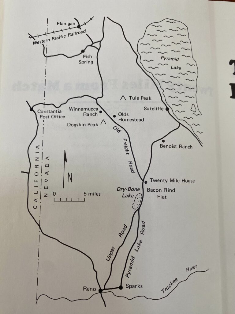
Her book indicates that there were two routes to cover the approximate 35 miles to her home. One is 445, the road to Pyramid Lake with a turn onto the Old Freight Road which went north through Winnemucca Valley and to Fish Springs and on to Oregon. It’s called Winnemucca Ranch Road today. The other she calls the Upper Road and is northwest of 445 and clearly undeveloped. It makes its way through Hungry Valley and intersects with Winnemucca Ranch Road near its intersection with 445 (which is a little different from what her map shows). That’s the road we took as we figured it would look more like what Sarah experienced, and it didn’t disappoint.
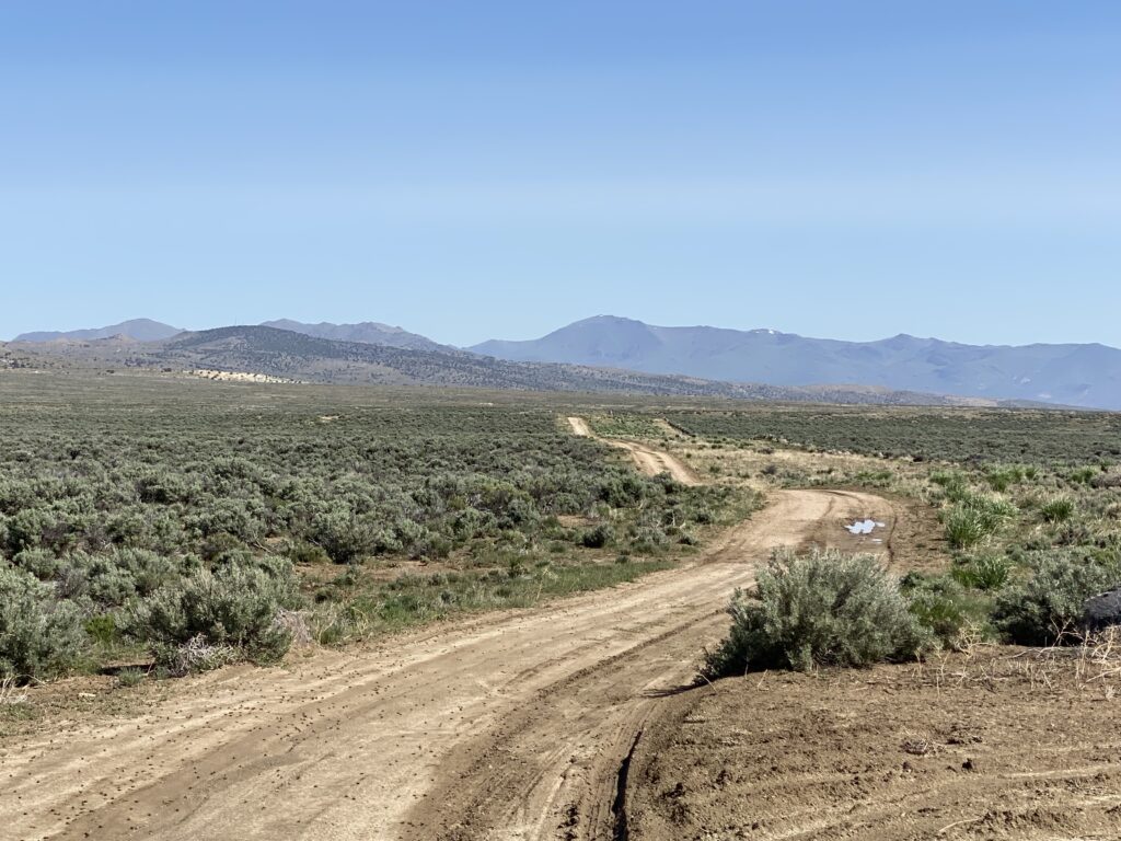
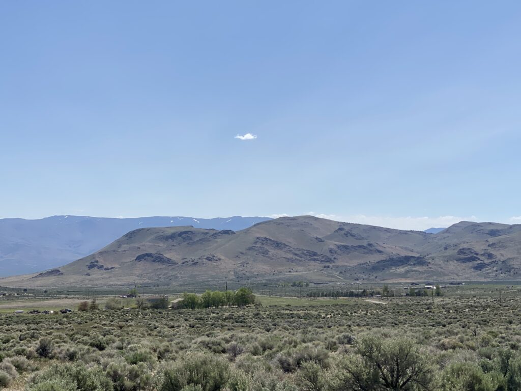
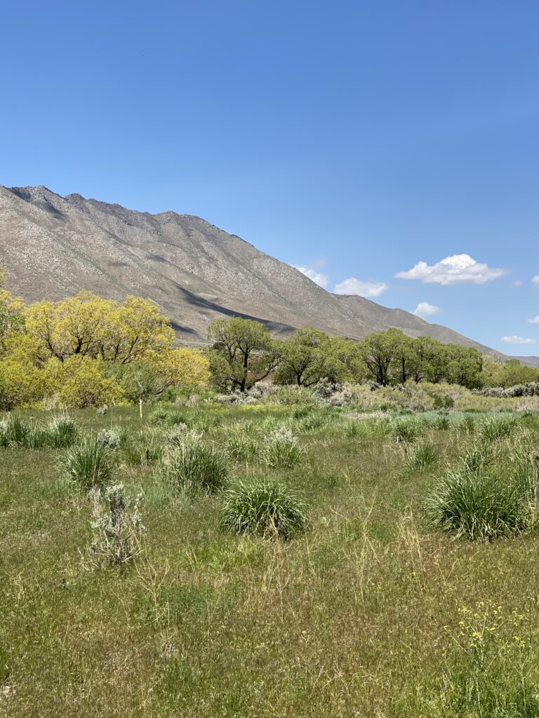
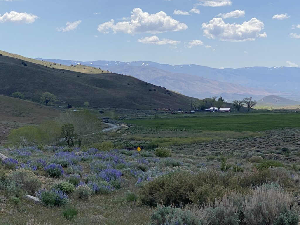
To get there, take Eagle Canyon Road west from 445. Once you crest the hill, you’ve left the urban smear behind and you could be back 100 years. This view is of Hungry Valley, where the only sign of human habitation is the road.
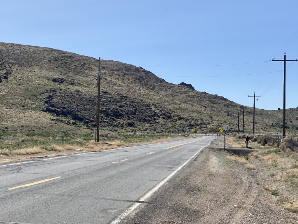
The road is paved to the small, well-kept Reno-Sparks Indian Colony which you’ll pass by. You pick up the Upper Road on the north end where it heads northeast to Winnemucca Ranch Road. It’s dirt roads from here on.
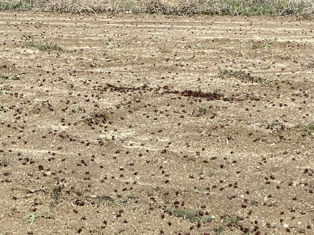
We encountered a small swarm of baby Mormon crickets there––the only time we saw them on this trip.
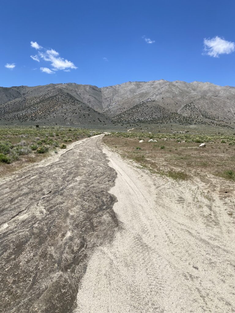
The road forward is primitive and probably looks about like it did when Sarah headed out with a horse and wagon. There are offshoots; try to stay on the “evacuation route”. There are signs; watch for them.
You will eventually reach Winnemucca Ranch Road near its intersection with 445. This area was known as Twenty Mile House and it figured large in the lives of settlers who populated this region over 100 years ago. This was a stopping place for horse and foot traffic; a place to seek shelter, water live stock, rest, sleep, and eat. It was a stopover on the Oregon Trail and was in continued use for traffic to Pyramid Lake or on to Oregon.
During one severe summer, daughter Alice injured her shoulder which became infected and required a trip to the doctor in Reno. Sarah set out with Alice and the horse and wagon at 2 a.m., the general starting time for such a trip. It was always at least a two-day trip and Twenty Mile House was well used by the family. On this trip, Sarah stopped to water the horse, hoping for a cup of hot coffee to help her make the next 20 miles. She had the fire ready to go and coffee in the pot, realizing that she had no matches. And she was “twenty miles from a match.”
Some years later, when a 600-man road crew was working in the area, an entrepreneurial older madam built a saloon, several cribs, and opened a thriving brothel business on the site. Sarah would only stop to water the horse although she did have an opportunity to talk to a prostitute. “It was the only time that I knowingly talked to a prostitute, and I felt disgraced for life.”
The house burned down in 1911 but the County maintained the well as long as foot, horse, and eventually auto traffic continued. There’s nothing left of Twenty Mile House today; just the crossroads now and a few homes.
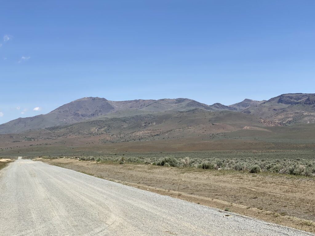
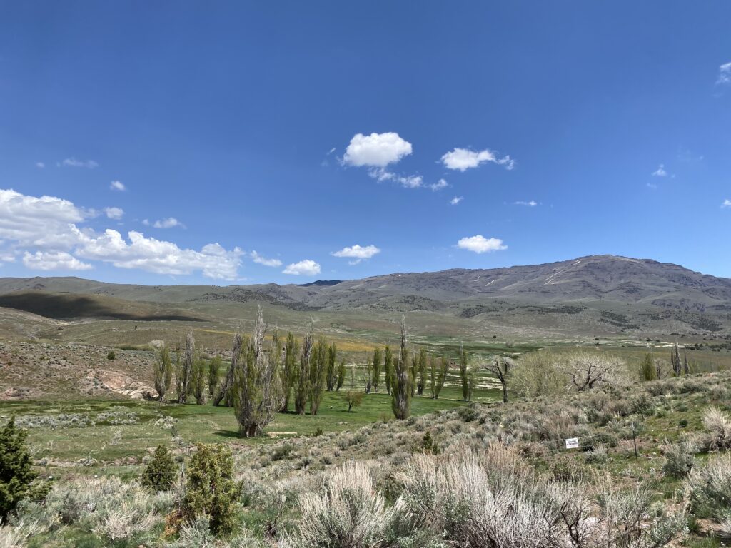
Winnemucca Ranch Road goes northwest past Palomino Valley, which is the last civilization you’ll see for a while. It shortly becomes a graded road, and once past the Air Sailing and Glider Port, you could be back 150 years.
Warm Springs is a verdant area just north of the gliding center. It is flush with water this time of year.
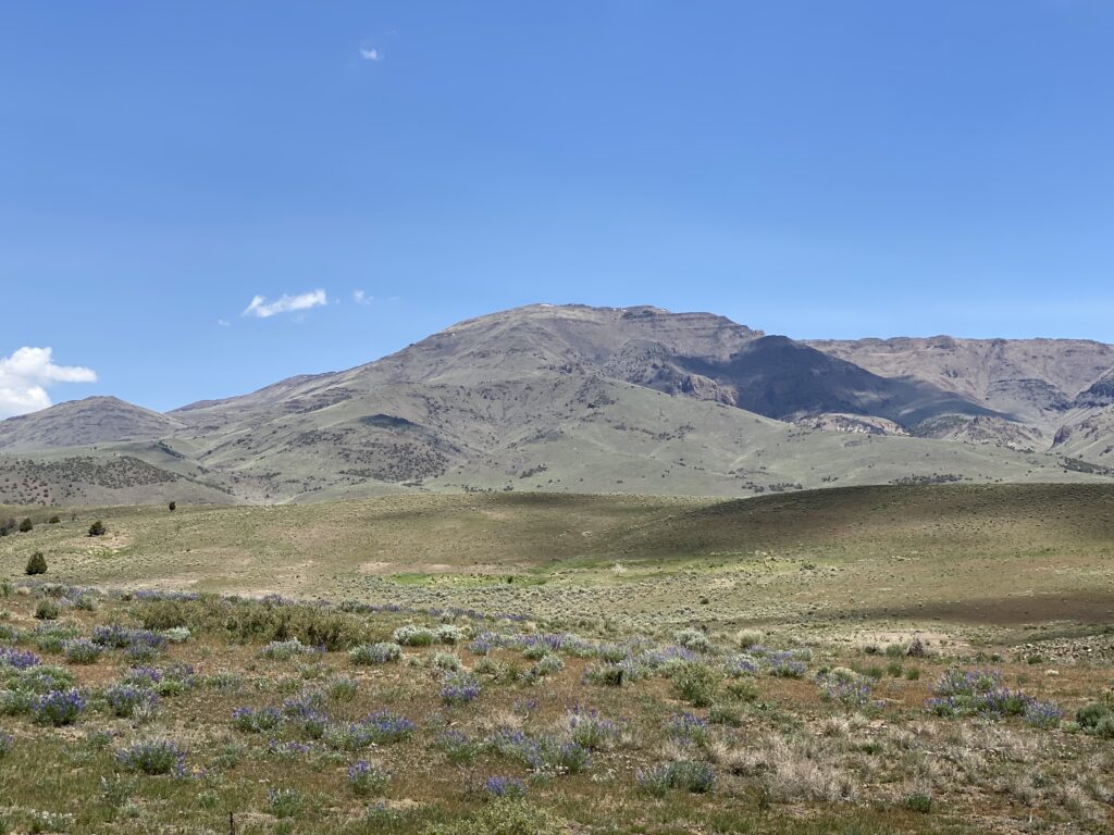
Winnemucca Valley lies between the Virginia Mountains on the east and the Dogskin Mountain on the west. Dogskin Mountain proved to be a ripe place for coyote trapping and Sarah’s son Edson became quite productive in trapping and skinning. The money from the hides, sold in Reno, was crucial to the success of the homestead in their early years. He became so proficient he could skin a hide in three minutes. He became an expert judge of furs and was affiliated with a large New York firm of furriers later in life.
At the time the Olds lived in the valley, the Virginia Mountains and Tule Mountain were great game country with abundant deer, sage hen, mountain and valley quail, doves, and some cottontail and jackrabbits. This game provided yet another source of income for the homestead.
Local lore says that Tule Mountain was named for Tule Frank who lived at its base. He hauled hay that was full of tules and sold it in Virginia City. There is a monument on Tule Peak started by hunters who stacked rocks and placed tobacco or baking soda cans with their names, address, and date written on paper inside. The cans were placed within the rocks of the monument and it continued to grow every year. Sarah reported that when she last saw the monument it was 8 feet high with many prominent names in the cans.
There are only two ranches you’ll see in this valley. The first one is in the general area where the Olds homestead was although it was farther east.
The historic Winnemucca Ranch which was there when the Olds were, is still in operation and you’ll see fencing and developed water sources for livestock. You can see a remnant from an original ranch building in the trees on the east side of the road. Both of these ranches are indicated on the Benchmark map.
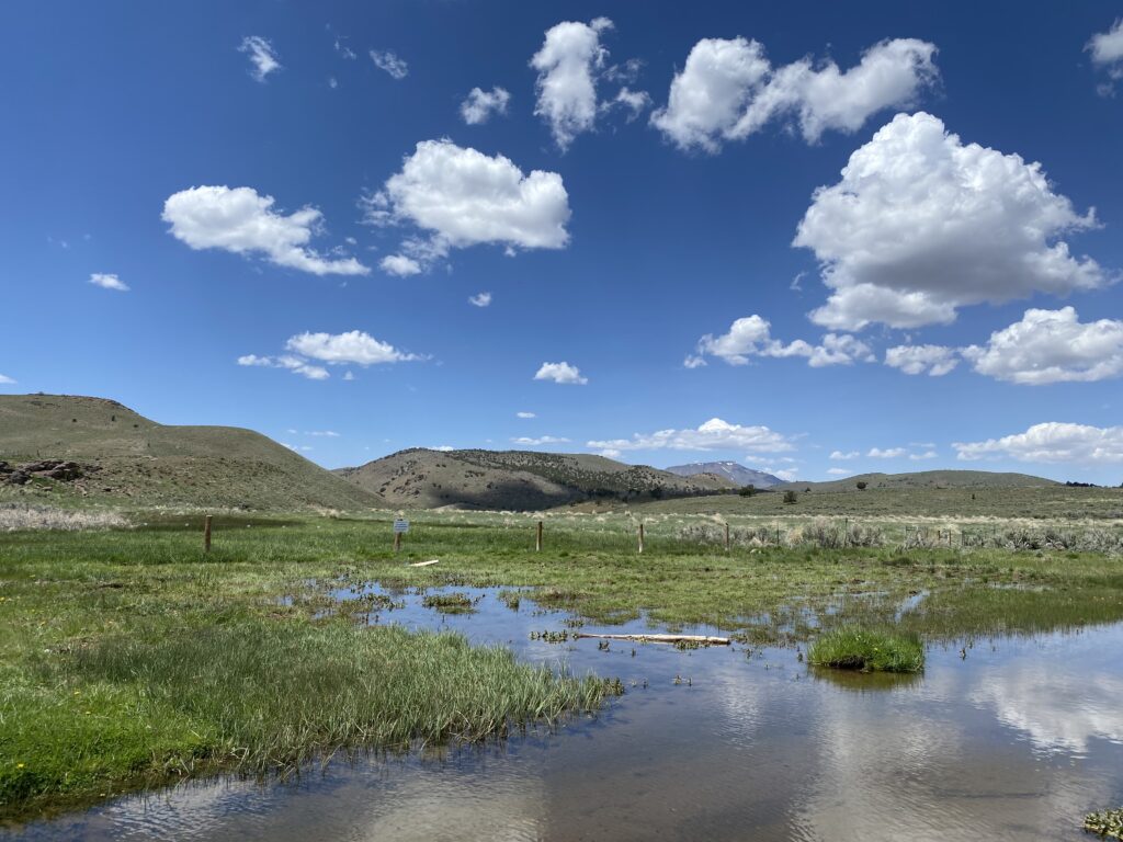
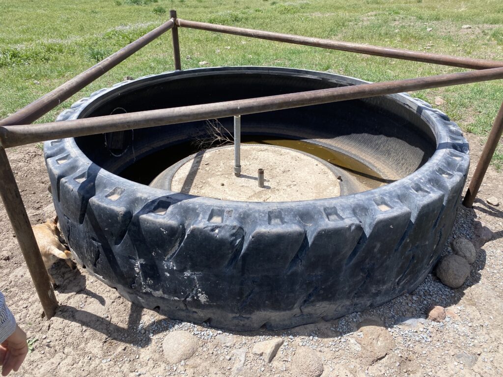
There’s quite a bit of water around the Winnemucca Ranch and areas where it has been developed for livestock.
Winnemucca Ranch
Water development
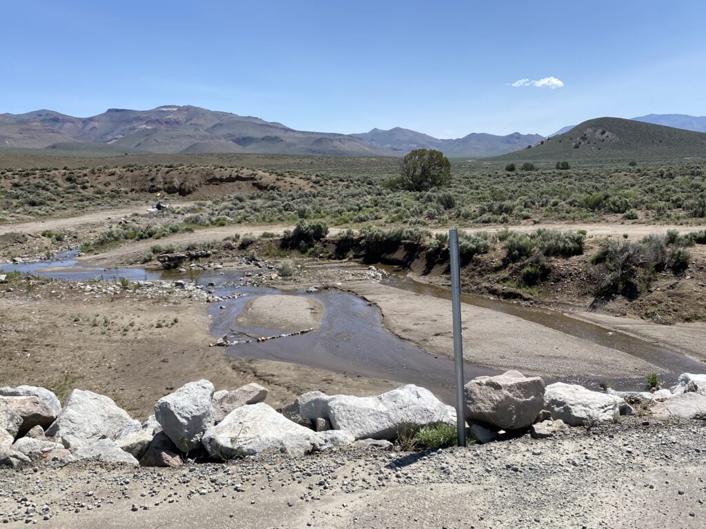
You’ll encounter two closed gates that you can pass through. Be sure to close them. In one place you must ford a stream that was about two and a half to three feet deep.
The road north from the ranch becomes more difficult so don’t attempt it if you aren’t comfortable with unimproved roads and rock fields.
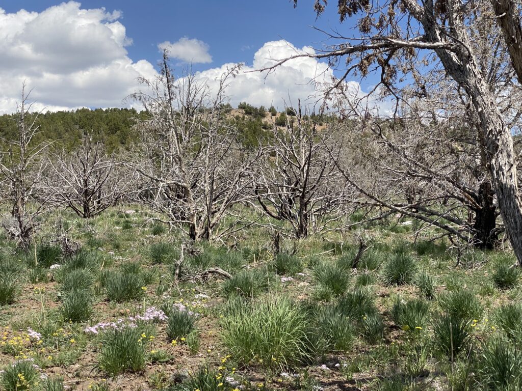
Just past the ranch there’s a burned area with ghost-like juniper skeletons.
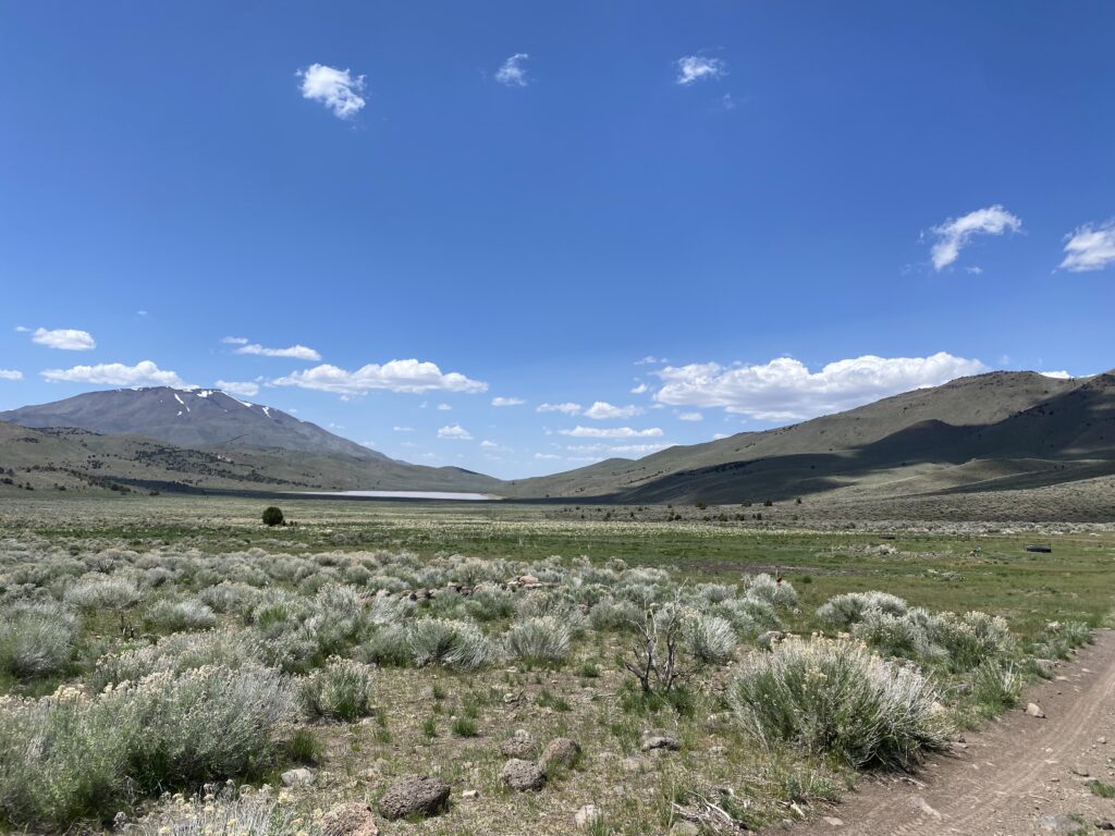
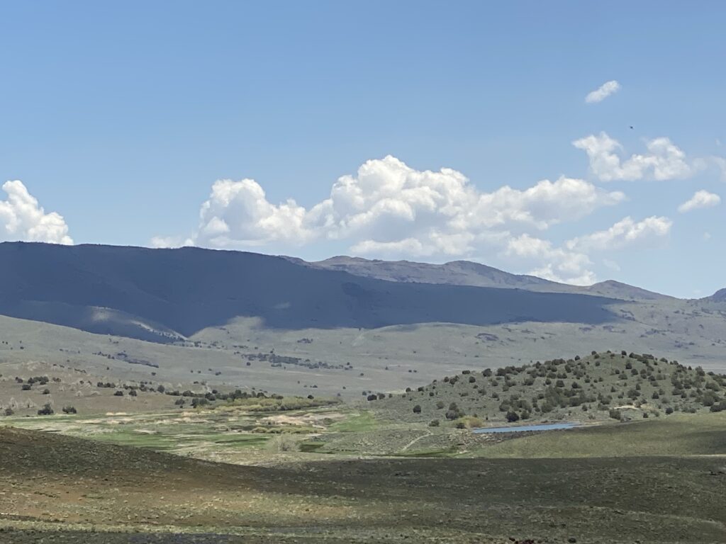
You can see the road before you snake through the countryside. This is a previously burned area with no juniper and it is slow going due to the road condition. You can see Newcome Lake in the distance
There are water sources in the area and unique water collection technology for livestock.
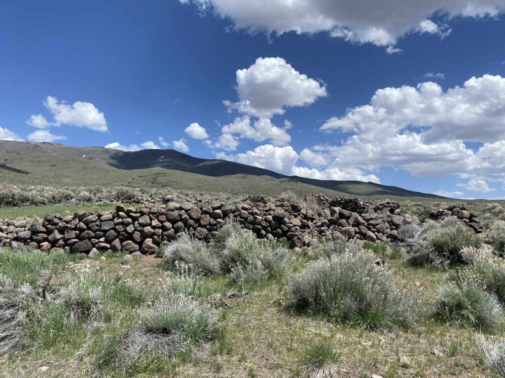
Watch for the old stone corral on the east side of the road.
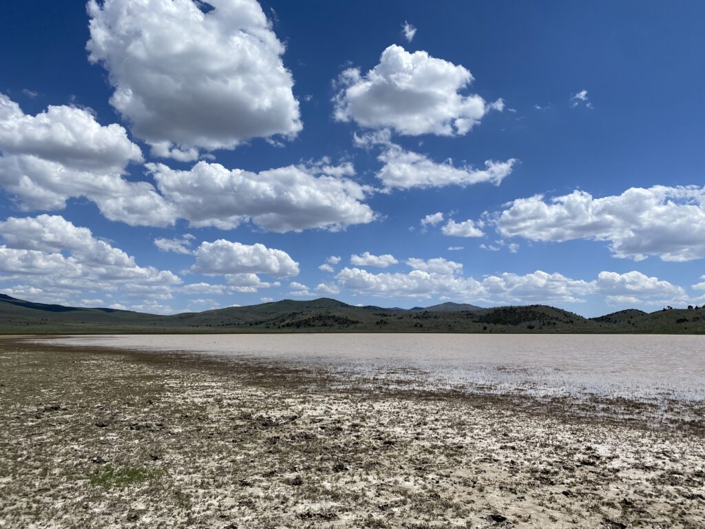
Newcome Lake is alkaline and opaque. Maybe if it was really hot, a swim in those waters would be welcoming.
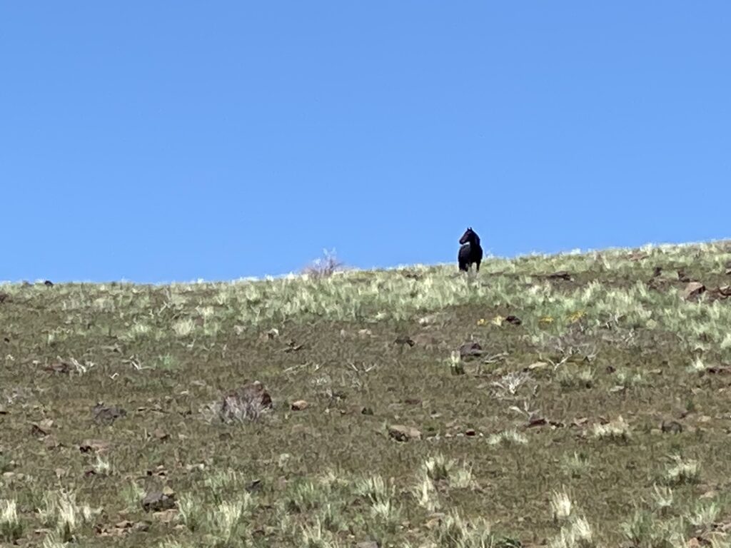
Despite the historic abundance of game and wildlife, we only saw this loan stallion.
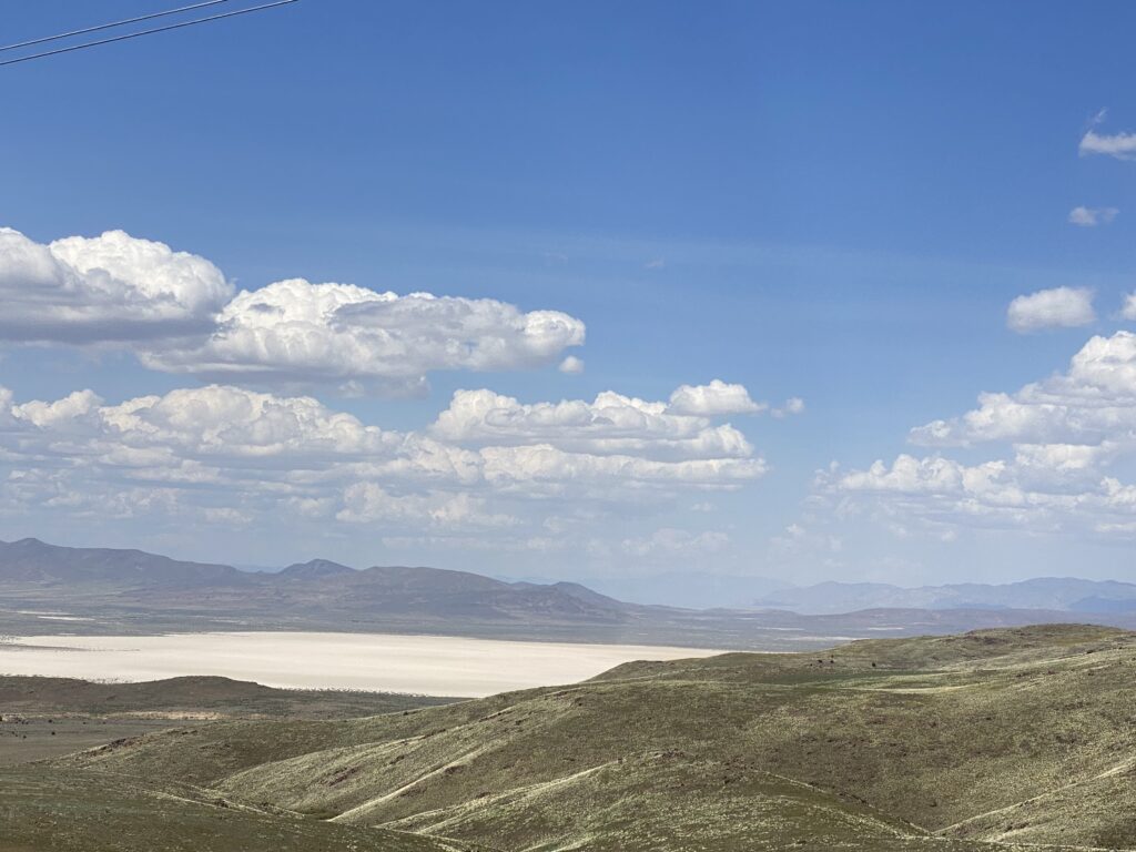
Coming down out of the valley, the view is of Honey Lake Valley.
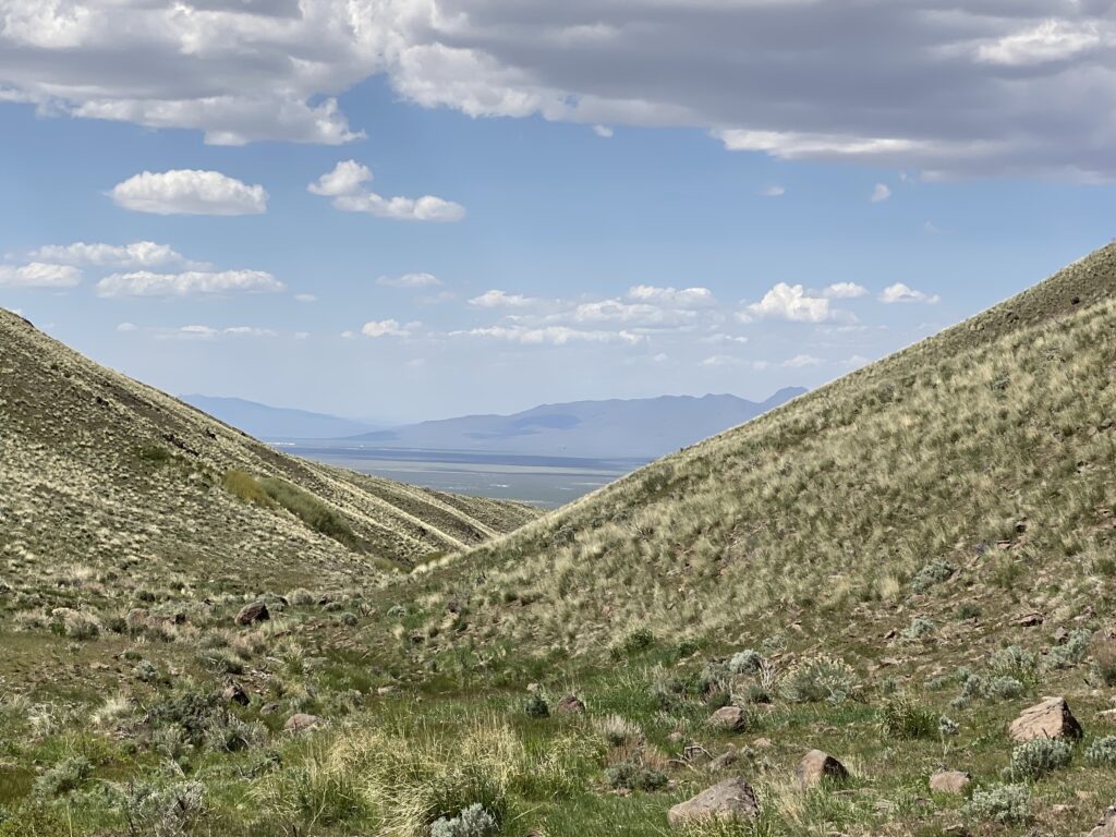
On a clear day, you can actually see Honey Lake to the west, assuming it has water.
Alkali Flat is to the east.
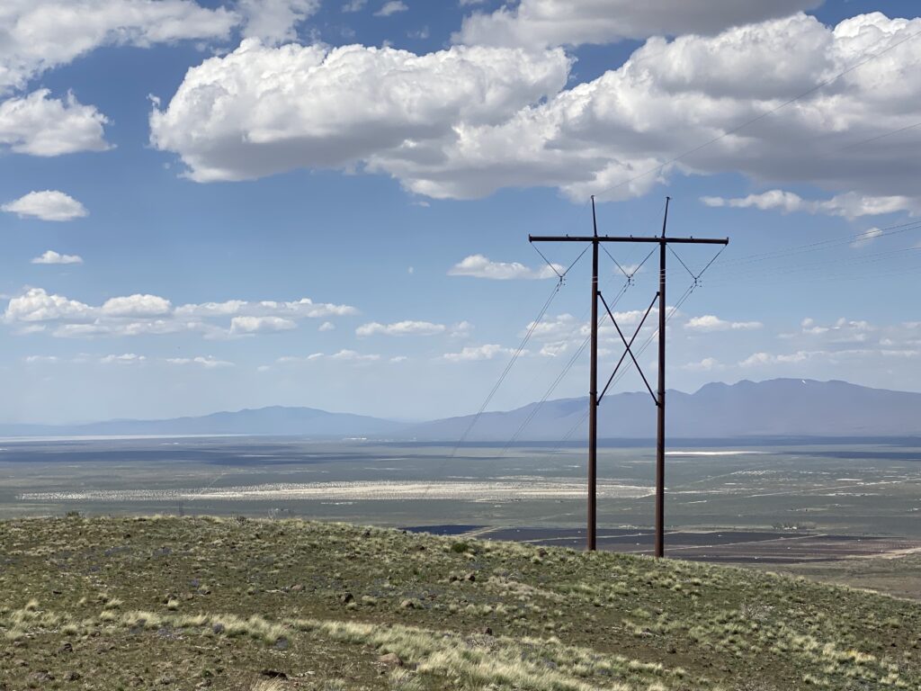
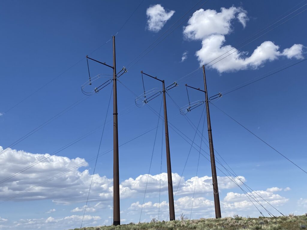
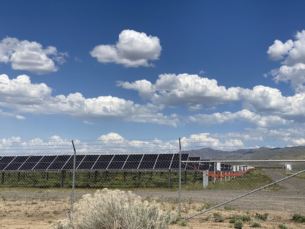
There’s a solar array on the south side of the valley and you’ll pass by the power lines as you descend into Honey Lake Valley.
Solar array in Honey Lake Valley.
Our route followed Flanigan Road which runs along the Union Pacific railway cutting through Honey Lake Valley. There’s nothing in Flanigan except of piles of railroad ties. Following this route through Astor Pass brings you to the north end of Pyramid Lake at the Needles.
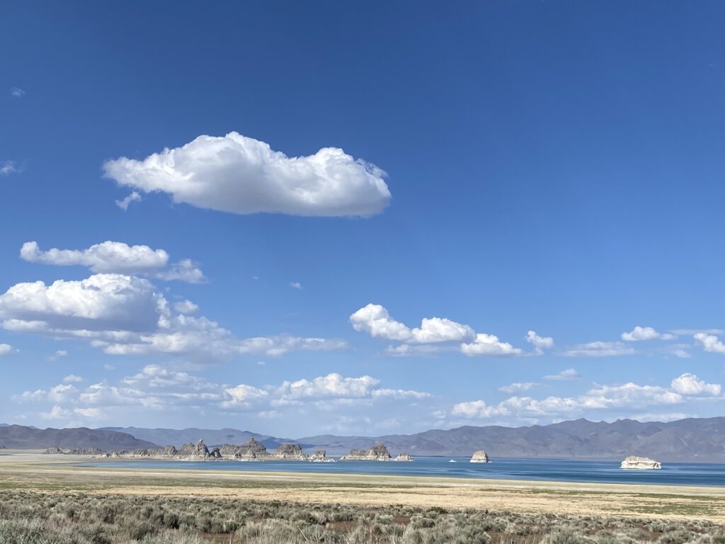
On a clear day, you can see the Pyramid across the lake.
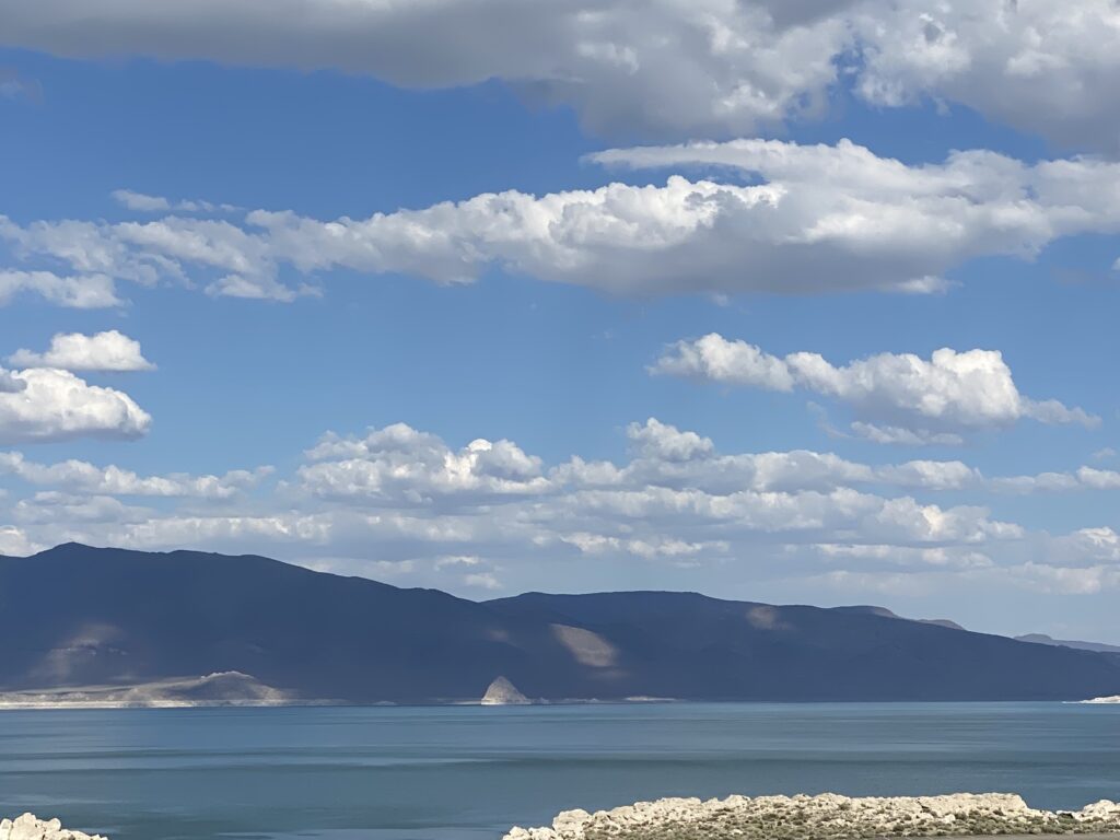
We came down the east side of Pyramid Lake and then onto 445 heading southwest to Reno.
Notes:
If you take the full trip like we did, you will need a good 4WD with fairly high clearance. We had a 4WD Toyota Tacoma and did just fine. You can always turn back at the closed gates at Winnemucca Ranch where the going gets tough, and it will still be a good trip.
We took about 8 hours and stopped frequently along the way.
Have a good map. We used the Benchmark Nevada map.
A compass comes in handy so take one. The web of dirt roads can be intimidating; just make sure you are traveling the in the direction.
If you take the trip let us know!
Sutro Tunnel Update: Step Inside “Impossible”
By Taylor Hamby
Friends of Sutro Tunnel Charity
When NevadaGram last visited the Sutro Tunnel in February 2022, readers accompanied the intrepid reporter David Moore and our own Robin Cobbey on a vicarious visit to the historic Sutro Tunnel and Site in Dayton.
(See: Sutro’s Tunnel Vision, May 25, 2022)
NevadaGram’s dispatch from the town formerly known as Sutro was the last formally assigned article from NevadaGram’s fearless leader David W. Toll. “Go see what’s going on over at Sutro,” Toll said from NevadaGram World Headquarters in Gold Hill.
Saturday, February 12, 2022 was a Media Day organized by Chris Pattison, the then-newly-minted Site Manager of the Friends of the Sutro Tunnel Charity (FOST).
FOST had assembled in recent years as the officially unofficial stewards of the iconic Sutro Tunnel & Site. The group became a genuine, bonafide Nevada non-profit organization in 2021.
When NevadaGram last traveled the winding suburban sprawl through a freshman Dayton neighborhood past Sutro Elementary School and onto “No Number” Sutro Tunnel Road, it was the first tour of the season. Regular guided tours–now a bimonthly occurrence during the Season in 2023–were still a hopeful dream at that point.
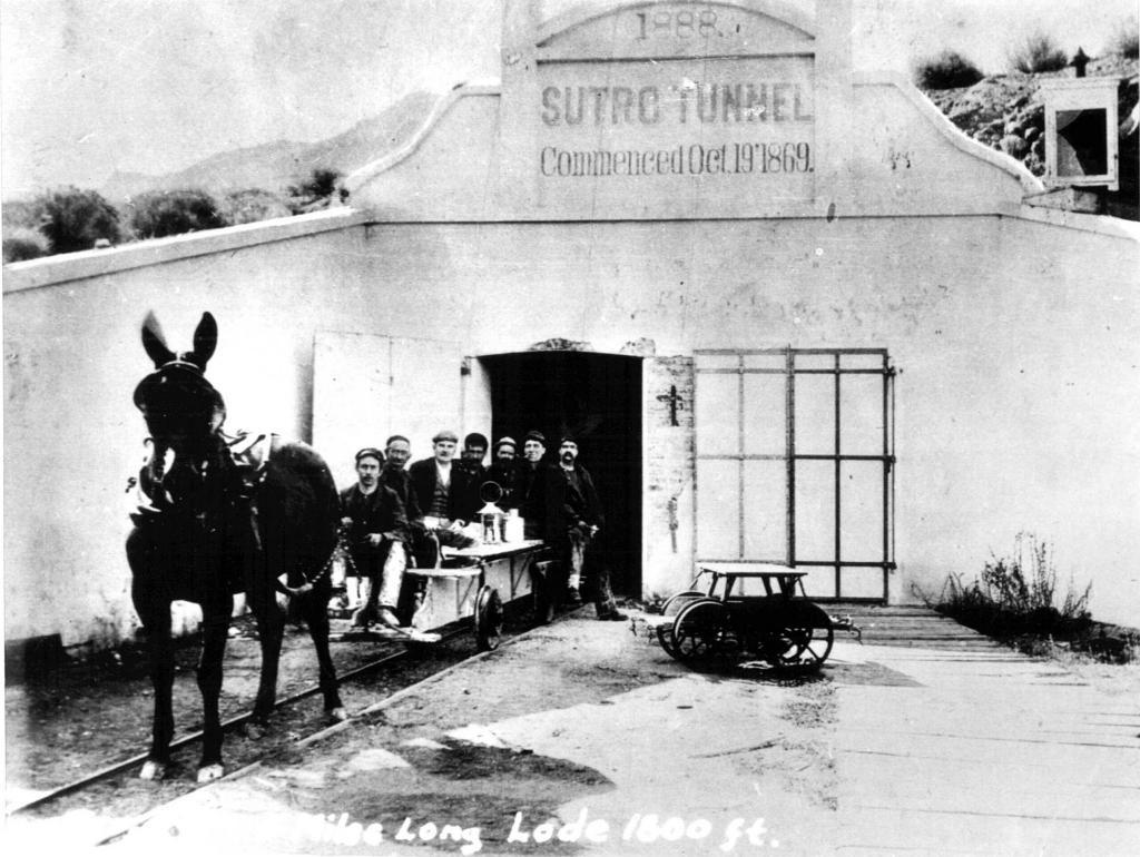
The idea that the Sutro Tunnel––which had collapsed after a faulty late 1970s-era rebuild courtesy of Houston Oil & Minerals––could ever be safely set foot in again, let alone rebuilt, was seen as a fool’s folly on par with Adolph Sutro’s original idea to build the tunnel in the first place.
“Everyone told me impossible––never going to happen,” Pattison says of his initial inquiries into what it might take to reopen old man Sutro’s tunnel. Luckily, Pattison says, he was new enough to not know it was an impossible feat and began taking steps in the direction of rebuilding the iconic structure.
There were the collapsed timbers from Houston Oil & Minerals’ defunct rebuild to reckon with, which, on their own was enough to make a harrowed historic preservationist tip-toe backward in silent retreat.
But then there was also the giant, gaping hole just on the other side of the iconic Sutro Tunnel façade.
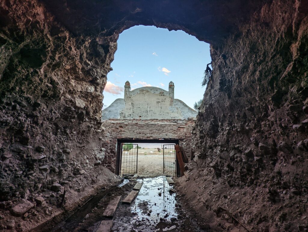
And the swampy, muddy mess on the floor created by the Sutro Tunnel herself, as she attempted to keep up with her initial intentional function of sloughing out excess water from the Comstock Mines.
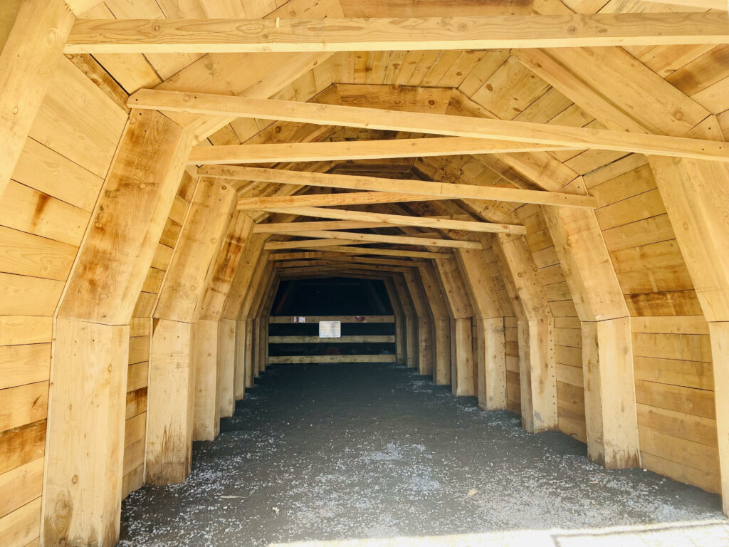
Almost one year to the day of NevadaGram’s last Sutro visit, folks could begin to step foot inside impossible. The first 50 feet inside the mouth of the tunnel was rebuilt, using Adolph Sutro’s original design and 160-year-old Tahoe lumber, by February 2023.
Now, two guided tours a month are offered from April through September. These 2.5-hour guided history tours are led by a rotating cast of Comstock history experts such as Pat Neylan (maestro of St. Mary’s in the Mountains Museum in Virginia City, NV, and the Dayton Museum), Lee Brunell (dedicated Donovan Mill in Silver City volunteer) Dan Webster (author of Mills Along the Carson River) and Chris Pattison, the enthusiastic public face of the Friends of Sutro Tunnel Charity.
“Chris, no offense, but when I first heard these tours were $65 bucks I was worried they were a little overpriced,” Sutro Tunnel docent Lee Brunell said on a recent tour. “Now that I’ve been on and seen several of the tours, I can say without a doubt this is a $100 tour.”
The Sutro Tunnel & Historic Ghost Town of Sutro is open to explore & tour on the following dates in 2023:
– Wednesday, July 19
– Saturday, July 22
– Wednesday, August 23
– Saturday, August 26
– Wednesday, September 20
– Saturday, September 23
Tickets must be purchased in advance online or by calling 775-900-0507. Kids 12 & under free.
Private guided tours are also available to set up at www.thesutrotunnel.org.
Jeff Nicholson’s Art Show in Elko
If you are anywhere near Elko this summer don’t miss the exhibition at the Northeastern Nevada Museum. Jeff Nicholson’s 40 Years Painting Nevada is a retrospective of his career painting the Nevada landscape, architecture and more personal subjects. The exhibit runs through August 27. Check out of some of the pieces in this slideshow.
Parting Shot: Golden Chain Tree in Virginia City


I enjoy these articles every month
Thank you
History is such an important part of our present
Excited for more