by Richard Bangs
It feels like we’re driving to the edge of the world where the water falls off.
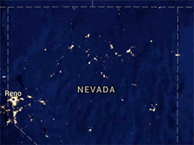

If you look at a satellite photo of earth at night one of the brightest pixels is Las Vegas in southern Nevada. But, if you look north, to the bole of the state, you see one of the darkest areas. What is out there? Who is out there? My ignorance is encyclopedic.
Meet Richard BangsRichard |

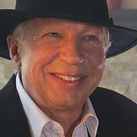
With friends Didrik Johnck and Adam Rose-Levy we map out the long way through the backside of Nevada, from Las Vegas to Reno. We could fly this connection in minutes, or take the freeway in a day, but we’re going to take a week scrawling through one of the loneliest passages in the world.
 |
We begin the journey from the Downtown Grand Hotel in Las Vegas, just footsteps from the action of Fremont Street, and a half-block from a celebration of the city’s notorious roots at The Mob Museum. We pack up, head out, freed from the arguments of civilization, and wind around Lake Mead to Boulder City. Lake Mead looks as shimmering and desolate as it did when I was a river guide in my teens.
I used to pilot inflatable rafts down the Colorado through the Grand Canyon, and the take-out then was Temple Bar Marina, about a day’s motor (we used 20 hp Mercs) across a brutally hot and barren channel. Sitting in the back of the 33’-long pontoon raft, the engine droning, the heat searing, I felt for the first time a seam open onto a void whose terrible content is the inevitability of finality, and it raced the blood and evoked feelings of being more alive. It was that kind of place.
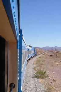
We make our first stop at the Nevada State Railroad Museum in Boulder City, which harbors the train that carried the supplies to build the biggest dam in the world at the time: Hoover Dam.

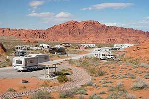

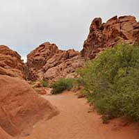
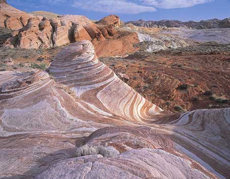
From Boulder City we wheel across the Mojave Desert to the Valley of Fire. This is Nevada’s oldest and largest state park, but still just a fragment of the over two million acres of designated wilderness in Nevada. It erupts from the land like a big pot of calcified soapsuds. The 150 million-year-old rock is mostly blazing red Aztec sandstone, eroded into phantasmagorical lumps and wedges.



Then, beneath the scarp of purple nightfall, we’re off up the Great Basin Highway, running through a watershed named by explorer John C. Frémont in the mid-1800s. The region comprises not one but at least 90 basins, or valleys, and its rivers all flow inland—not to any ocean. If you are running water, you can check in, but you can never leave.
Under a stanza of stars, seemingly amplified by the high desert air, we find our way to a set of cabins on a ridge under a windmill outside of a former horse thief resting station called Alamo. Even with a bakery featuring generously-sized homemade pastries, it does seem like a last stand.
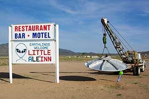
The highway is adjacent to Area 51, the super-secret Air Force test facility, whose existence the U.S. Government didn’t even officially acknowledge until recently, and which many believe is holding a ménage of little green intergalactic pilots and their downed spacecraft.
There is a single shop at the intersection, ET Fresh Jerky, with a large sign out front “DROP YOUR TOXIC WASTE IN THE CLEANEST RESTROOMS IN AREA 51. FREE SAMPLES.” Who could resist? We park, and walk in. Aliens do have the power of mind control.
Inside I meet manager Dixie Scabro. She’s quite friendly, happily ringing up my purchases, but none too chatty. I ask if there might be any relationship between alien cattle mutilations and this jerky outlet. She shakes her head no. I probe some more, asking about Area 51, just beyond her doorstep, but she just clams up. What secrets is she hiding? She won’t tell. Instead, she directs me to the Alien Research Center, just down the road. “But, it’s never open,” she warns.
Back on our telluric adventure we weave through a landscape that looks as though left in the sun too long. We stop at Caliente, named for the hot springs in a cave at the base of the surrounding mountains. It was once the center of a railroad war, as it is the half-way point between Salt Lake and Los Angeles and rival barons wanted to own the tracks. When steam engines were replaced by diesel locomotives in the 1940’s, the division point moved to Las Vegas. Now Caliente seems the backside of an idea, more wish than reality, a semi-ghost town with about 1000 residents.
Here we meet Mayor Stana Hurlburt, whose office is in the old Spanish mission style railroad depot. She shares she is hoping to reinvigorate the town by turning it into a mountain biking mecca, similar to Moab. It has the terrain, to be sure, and no crowds or spandex, yet. She may be on the right track.
We round out the day visiting Cathedral Gorge State Park, a long, narrow valley where erosion has carved stagy spires and basilicas in the soft bentonite clay. It looks like the maria of the moon.
Ranger Dawn Andone takes us on a hike through earth’s artistry, into twisting slot canyons, around church-like steeples, beneath buff-colored cliffs, and by the fluted hoodoos carved from remnants of a great freshwater lake millions of years old. “How did all this happen?” I ask. “Sedimentary, my dear Richard,” explains Dawn.
Pioche was once the baddest town in the West, badder than Tombstone, Deadwood or Dodge City.
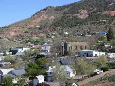
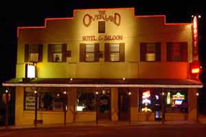
Now it’s another living ghost town, and we take the night at the only accommodations around, the old haunted Overland Hotel & Saloon.
We break the seal of night with a home-style breakfast at The Silver Café across the street. Then, we hook up with local historian and amateur gunfighter Jim Kelly offers to show us the Boot Hill Cemetery, where, in its boom years, 72 people died of lead poisoning, croaked with their boots on, before anyone died of natural causes.

Alongside Murderer’s Row, a section in the cemetery with markers for over 100 murderers, Jim hands me a six-shooter, and challenges me to a gunfight. Somehow, I win, and he crumples like a kicked tent down onto the grave of his great grandfather, shot down by local rival.
Next we hare past fields of alfalfa and through a couple of state parks centered around man-made reservoirs, Echo Canyon and Spring Valley, both of which might be designated Ghost Parks this time of year. Next we hare past fields of alfalfa and through a couple of state parks centered around man-made reservoirs, Echo Canyon and Spring Valley, both of which might be designated Ghost Parks this time of year.
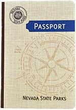
Almost like a Twilight Zone episode, or The Rapture, every human seems to have been plucked from the landscape, though all the facilities…bathrooms, picnic tables, campgrounds, boat launches, information signs, a stamp machine for the state park passports…are perfectly presented, waiting for a dinner party. It’s nice having these resplendent parks to ourselves, and we take some short hikes, skip some rocks, take some pictures, and then start driving north.
Looking at the map, it seems there might be a shortcut over the Mount Wilson Byway Road. It’s a gravel road, almost entirely through BLM land, that crooks through a volcanic caldera overgrown with pinyons, junipers, and, as we climb higher, snow. This is a stunning drive, past high peaks, around councils of aspens, ponderosa pines, and the exquisite non-existence of right-angled civilization. Even in our GMC Yukon, in four-wheel-drive, we skid and swerve in the ice and snow, sliding sometimes like a fried egg on Teflon, but finally crest the snow-covered pass at 8,900’, looking over to the great girth of original country, and beyond to a sere horizon.
Then we slowly unwind the back side, calipering back down to Route 93, and then northeast to the border, passing along the way herds of roan horses, wild and running, more here than in any place in America.
It’s a chilly, stelliferous night; I can reach up and nearly touch the spill of The Milky Way. It’s so bright I cast a shadow.
This is a privilege, and ancient right. More than two thirds of the U.S. population, about half the EU population, and one fifth of the whole world lives where the possibility of seeing the Milky Way with the naked eye is no longer. Here, it is practically splashing into my lap.
At the visitors center we meet Ranger Kelly Carroll, who offers to show us around (we are the only visitors at the moment), and takes us on a short walk in the shadow of Mount Wheeler, second tallest peak in the state. 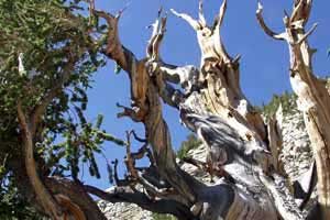
Since then, older trees have been discovered, but their locations are kept secret.
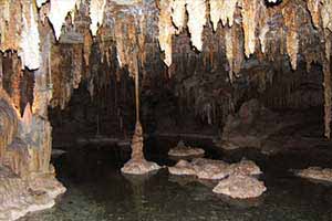
It’s a fairytale world, artfully lit, and I vow to return to bring my sons, and to climb Wheeler Peak.
Now we head west on Route 50, the former Pony Express route. 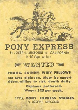

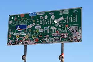
The route is now known as the Loneliest Road in America. In 1986, Life Magazine ran an article about Nevada State Highway 50 entitled “The Loneliest Road.” An AAA spokesperson had described the route through Nevada in these words: “It’s totally empty. There are no points of interest. We don’t recommend it. We warn all motorists not to drive there unless they’re confident of their survival skills.”
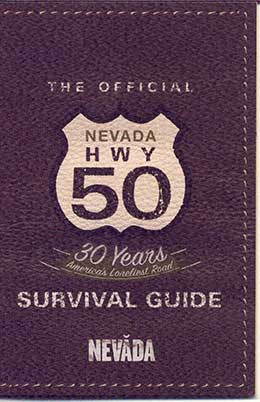
So many things about Nevada seem counterintuitive. In that vein, Nevada tourism officials seized on The Loneliest Road pejorative as a marketing slogan, and created signs, stickers and brochures touting such.
They were right, though, as the lonely quality also makes this one of the most sublime corridors I have ever experienced. Much of the time it reminds me of Jerry Bruckheimer’s film intro logo, the boundless straight road and the lightning bolt. After hours of nothingness, it seems we’re driving ever closer to the origins of the earth. A tumbleweed sweeps across the road, whispering some hoary invitation to explore beyond the pavement.
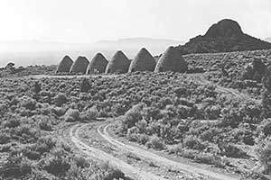
We seem to be navigating a large unfurnished chamber in this next stretch, but it is an occasion with room to think; room to breathe. The interstice is rich here.
In the little community of McGill we stop at the Rexall Drugstore, but it’s not like my neighborhood Walgreens. Stepping inside is like stepping through a time-warp, as though half a century ago the owner went out for a cigarette and never came back.
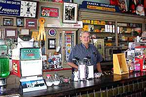
Daniel, an irenic soul who makes peace with the past, gives an archeological tour down the memory lanes, finally showing off the space in the back where home remedies and prescriptions were mixed in-store, next to stacks of original invoices, dating back to 1915. Before we leave he dollops double scoops of ice cream at the old fashioned soda fountain, and hands them to us to lick vanilla memories.
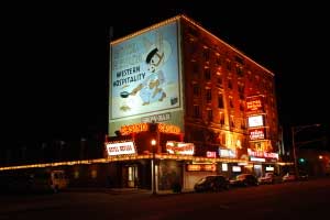
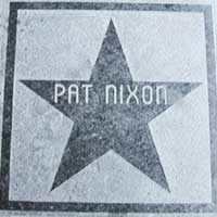
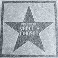
The receptionist draws a sly smile; silently hands me the key.
We take dinner across the street at the Cell Block Steak House, in which diners sit in jail cells, and are served behind bars by waiters with sheriff badges. The Gunslinger New York steak is to die for. If this is the grub in jails here, I confess to shooting Jim Kelly back in Pioche. Lock me up.

We venture into the Owl Club Bar and Restaurant, noteworthy for its imposing taxidermy, and history of gunfights, dances and rollerball (it was once “The Rinky Dink Roller Rink”). We share lunch with recent owners Eleny Mentaberry and her bar-tending husband Scooter (he calls himself a Precision Carbonation Specialist).
Scooter is part Basque, and there are quite a few in the area, immigrant sheep herders who found a landscape welcoming. 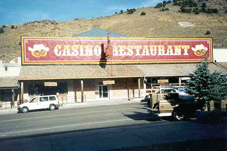

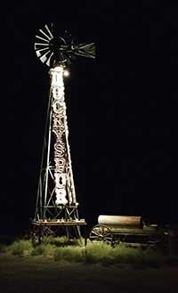

Mike Zacharias, the owner, has packed the place with ludic collections, cowboy photos and art, including over 100 spurs, and Rory Calhoun’s vest, which he is sporting as he sips and spins tales. There’s a fantastic story behind every ornament and picture, and it’s easy to believe them all. At one point Zach says “I used to ship bulls for a living…shipped them all over the world. At one time I was the biggest bull-shipper in the world.” I do believe the man.
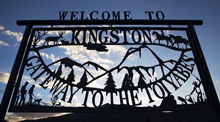

After John’s blueberry pancakes, with sides of local fresh ranch eggs and toast with local honey, we head out from Kingston Canyon, tooling north, past a billboard that proclaims, “What Happens in Austin….You Brag About.” We are approaching the geographical center of the state. 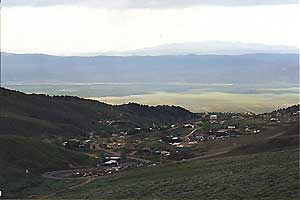
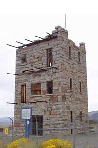
After a stop at the Toiyabe Café (killer hand-made milkshakes), and a gem-buying spree at the Little Bluebird Turquoise Shop (where I also buy what appears to be the authentic Aladdin’s magic lamp, and get my Loneliest Road passport stamped), we coil up a hill southwest of town to Austin’s most famous attraction, Stokes Castle.
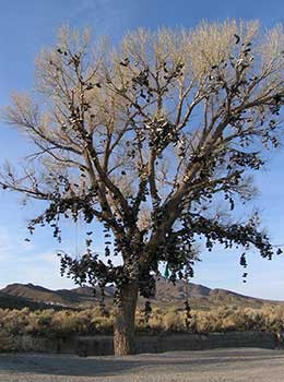

all spinning in the breeze like clinquant finery.
Rumor is the first pair was thrown during a wedding night argument by a young couple in the 1980s; later, their children’s shoes were added to the bough; then other relatives, and friends, and passersby, and a tradition was borne. It became, in short order, the world’s largest shoe tree. But what we are witnessing is not the original, which was chain sawed down by vandals on New Year’s Eve, 2010. Hundreds cried with the news. Now, a sister sapling, a few yards away, has become the replacement shrine, and something of a cause, and it seems to have sucked up all the discarded footwear in Nevada.
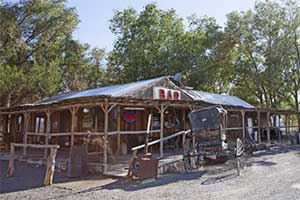
“What happened to the customer?” I ask.
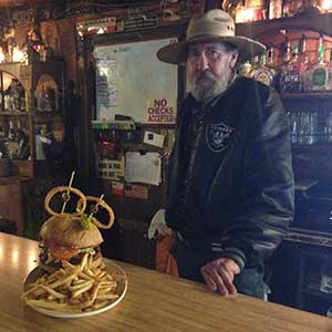

She has rules for consuming the Monster Burger, which earns a t-shirt (“I Ate the Monster”) if a challenger can finish it within her rules (you can’t leave table once you sit down, and you have to eat the mound of fries and fixings). I accept the dare, and, she sets down a jacked stack of beef as big as my head…it’s the LaRon Landry of burgers.
After an hour, I’m shaking in defeat. Fredda struts over to my table and plants a white flag in my remaining meat. “Richard, you’re not the first guy I made a wus out of. The monster got ya!”
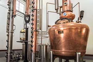
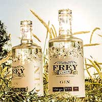
Our final stop is the Frey Ranch, 8 ½ miles south of Fallon, ground zero for Nevada’s craft liquor movement. In the last tail feathers of the day, we roll down a painterly lane, past barns, silos, vineyards, a line of old John Deere tractors, a gazebo, and a Prairie-style homestead built in 1944. Here we meet Colby Frey, who is making high-end, high-tech spirits at Nevada’s first legal commercial distillery.