
by Gage T. Smith
See Map at bottom
|

This feature is called “Nevada’s Dirt Roads”, and because we consider everything east of the Sierra summits as Far Western Nevada we are making a small foray into what shows on the map as California. One encounters the picturesque town of Bridgeport on US 395, about 37 miles south of Topaz Lake. Its setting at the base of the Eastern Sierra is worth the drive alone, and on the first day of Fall, it has a special brilliance.
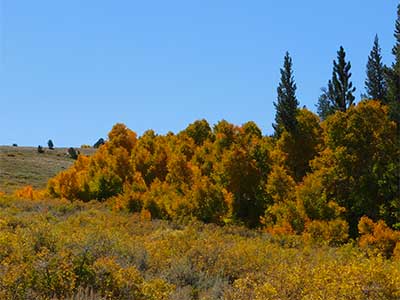 Travel about 8 miles south of Bridgeport; if you are alert, you will see the sign for a right turn to Green Creek. Take that turn but for your own sake take it in the next two to three weeks if you can. The Fall colors are . . . are . . . drop dead gorgeous. The colors are not quite at their peak on the first day of fall, but not far off either. For the next few weeks, fall’s cloak of color will be majestic.Most of this can be done in the standard SUV on up as the major portion of the road is well graded but occasionally rocky. The main portion of the road is spectacularly scenic and the little off roads are even better. It’s hard to get lost here, so any turn will take you to a great location and then finding the main road is easy. The main road which is well traveled will eventually take you to Virginia Lakes.
 Dunderburg is the common name for this area, in reference to the nearby Dunderburg mill and mine. Dunderburg means Thunder Mountain in Swedish. The tiny town that time forgot sports several relic cabins in various states of decay. Built at over 8,600 ft in elevation, the cabins had to be substantial and are made of some hefty pine logs.
The road in to Dunderburg town site is not easy. High ground clearance is a must and four wheel drive is more than recommended. It is something that the explorer has to find. I could tell you to turn right after the fifth road past the third turn next to the big rock with the dead tree but unless you have eyes and boots on the ground . . . not likely.
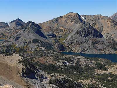 Before you get to Virginia Lakes, a turn to the west meanders up this rocky path and eventually puts you on top of Kavanaugh Ridge. At 10,800 feet, you are sitting at a rocky abyss looking out upon the Hoover Wilderness. If you look closely, you can count seven different lakes in this back country wilderness.
Dress warmly here because it is usually windy and cool, sometimes downright cold but it is worth the trip. This portion is not for your standard vehicle or even SUV. It is rocky and in parts is quite steep. Four wheel drive is a must to make this trip. Tracking down from the ridge, one can go to Virginia Lakes or head back on the main road toward Green Creek.
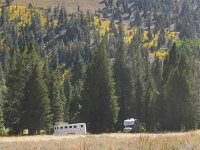
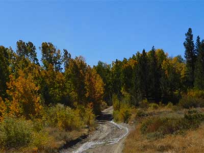 Green Creek is another jaw dropping canyon that is full of aspen and other fall trees and shrubs. This place can be popular with hunters and other outdoorsmen as there are quite a few primitive camping areas as well as an organized Forest Service campground at the top of the Canyon. It is also a jumping off spot for hikers entering the Hoover Wilderness. The primitive camps offer hidden areas adjacent to Green Creek itself.
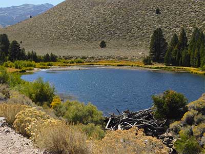 Green Creek is a year round stream that affords lots of water. As you enter the Canyon, you will notice a small lake and just above the lake is a plaque. This lake served as the penstock for a hydro electric plant that powered the mining operations of Bodie, about 15 miles away as the crow flies.
 Another interesting side trip is the road to Summers Meadow. It is marked just off the main road not far from the 395 junction. It is worth a leisurely drive up to roads end and then back track. Never being one to back track, I do it here because in this country, you never really see it unless you see it from both directions.All this will be over by the third week in October unless a big wind comes and ends it earlier. If you have the inclination for an adventure, pack a lunch, fill the tank and go.
The Picon Map of Dunderberg —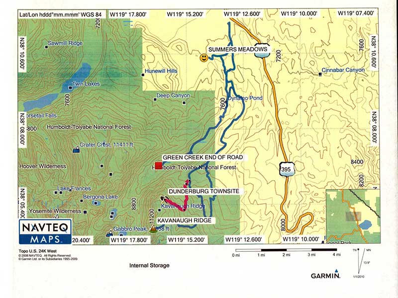


Never knew this was there – driven past this road for years ! Thank you for the information